Kudremukh National Park, Kudremukh, Karnataka
Brief History
Kudremukh national park is located in the Dakshina Kannada and Chikmaggalur districts of Karnataka. It is a Hikers paradise, a biodiversity hotspot in the western ghats (mountain range in south India) it was declared a national park by the Govt. of Karnataka in 1987.
The area previously mined for Iron Ore by the KIOCL company has since stopped its activities in 2006 by court order.
 The Journey
We started from mangalore on the 4th of december(best time to hike here December to March) at 1430hrs on 2 motorbikes( trust me there is nothing as fun as a motorbike ride!), 4 hikers. The road from mangalore to kudremukh is pretty straightforward, unless you are a complete moron or live in some godforsaken land and never heard of google? its hard to lose your way, and in the days of GPS its almost unheard of (Thanks Google!). The ride is approximately 110KM long and should take about 2.5hrs depending on the traffic, and of course the speed of the motorbikes! The roads as of now in 2013 are well paved and comfortable to ride. The route we took was Mangalore-Moodbidri-Karkala-Kudremukh, here's the link from google maps
 |
| The HIke To the Peak |
like i mentioned before we started in the afternoon of the 4th of dec, along the route mentioned above when you reach kudremukh you'll stop at a forest check post where you have to pay an entry fee of Rupees 275 per vehicle, mind you that you have to reach here before 1800hrs otherwise no permission to enter the national park. From here the winding curvy ghat roads begin, any motor biker would have fun! once the ghat roads are dealt you reach see major landmarks like the abandoned KIOCL mining company, the huge Lakya Dam which is almost dry and has only a sludgy sediment left and cows grazing on the walls overgrown by vegetation.
 |
| Unmistakable KIOCL mining company |
 |
Lakya Dam
The next Forest checkpost is where you have to leave your vehicle and take a 4x4 jeep also you register the names and total number of hikers here, there is a minimal threat from naxals, theoretically a motorbike with a single rider would make it to the top, but from here only the jeeps are allowed. The road winds to the top of a hill about 9KM the roads are really bad and rough if you don't hold on you will easily be thrown out of the 4x4. We reached the home-stay at 1800hrs, you can book these places for an overnight stay for around Rs 800 per head, this includes a room, sleeping mat, quilt and food, the details for the 4x4 and home-stay are at the bottom of the page, contact them before you plan a hike here!!
|
 |
| a really stupid way to drink water, but a cool photograph just zoom in and see! |
 |
| limbering up! |
 |
| Dinner is served, steaming hot chicken with roti and rice! |
 |
home-stay
After dinner get to an open area under the night sky and gaze at the ocean of stars above, interspersed with the occasional shooting star and comets, to a city dweller this sight is instantly etched into memory.
|
| limbering up! |
The hike
Woke up at 600hrs decided to get ready to leave by 730hrs after a heavy breakfast of course! We knew that keeping tome was essential if we had to enjoy the hike enough and be back in mangalore just before dinner. The plan was to reach the peak in a timing of 3 hours spend hours there and then assuming the hike down would be faster, to reach the home-stay by 1430hrs have lunch then take the 4x4 to where we parked the motorbikes overnight and head back to mangalore. Everything went perfect to the plan!
Hikers usually would take 4 hours to the peak with a guide whom you can hire for RS 500, we decided not hire a guide since we where used to doing things ourselves and a bit of arrogance!
what you'll need: 1 liter water per hiker some food to munch along a jacket to protect from the wind at the peak(optional! but cool)
|
| a really stupid way to drink water, you can collect water from the perennial streams |
The route starts from behind the homestay, the total distance is measured as 9 KM to the peak from the first mile marker which you will see along the route, its an unmistakable pile of rocks with the distance painted in blue (in english).
the trail takes you through the winding hillside down to the streams which you'll have to cross to get to the continuation of the trail through some tall grass then the peak comes into view, a flat faced point highest up in the sky.
|
 |
| The peak |
The first parts of the trail takes you through previously cultivated lands the evidence being terrace formations several guava trees springing up regularly the occasional rose plants, the first major landmark along the trail is Lobo house, its a pile of rubble now,you should be here by the 3 KM mark. The next major landmark is onthimara( single tree) the trail is pretty easy till here, from here on-end its a gradual slope progressing to get pretty steep till you reach the flat of the peak. The trail which is visible for miles justified the decision not to take the help of a guide, besides we had the company of a puppy dog that followed us for the entire hike!
 |
| our animal guide! |
 |
| onthimara, the big tree on the right of the photograph,the peak in the background |
Along the trail look for wildlife, you may see langurs, gaur( indian bison), sambha deer, spotted deer, wild dogs, hogs , if you're in luck the major predators like leopards and if you're really really lucky a tiger, recent census spotted 4 tigers in the area. the hills are interspersed with the Shola forests( large open areas surrounded by dense forest. Enjoy the wildlife, do not disturb, it may end badly for you!! there's a cuople of photographs of wildlife further down enjoy!
At the peak all you have to do is take a deep breath and marvel at the view! other than good photographs there is an abandoned church to explore just off the trail and apparently there is a small fort, however we did not explore it because of the time constraints, too bad for us!
 |
| Taking a water break at onthimara |
 |
| the abandoned chueh |
 |
A herd of deer seen in the deep center of the photograph
|
 |
| a sambha deer running away from us,try to find it, camouflage! |
 |
| hoof prints |
 |
| drinking water! |
 |
| this is for Karthicks girlfriend if you ever read this! |
 |
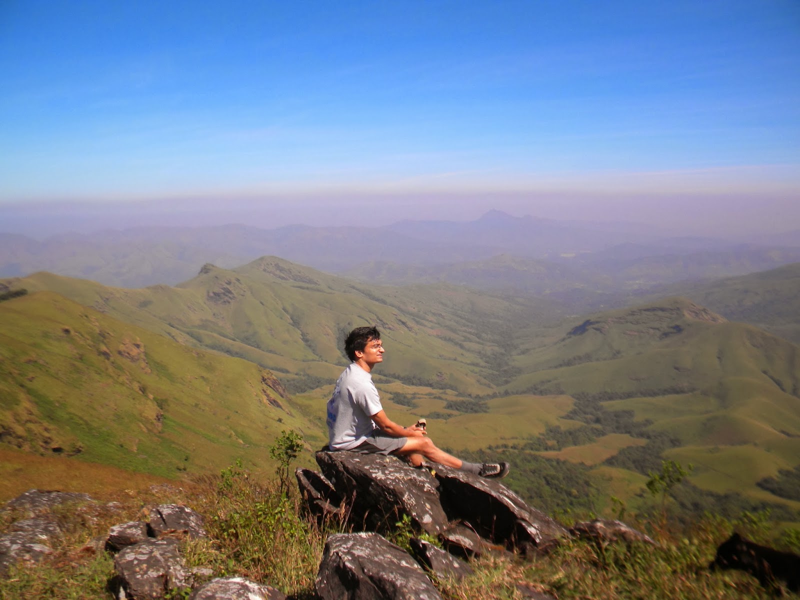
| the valley below, vieweed from the edge at 1892 meters |
 |
| Shola forests |
 |
| the pool jump |
 |
| Super-man pose |
 |
| Spider-man pose |
 |
| the hikers from left to right; Karthick, George, Dileep, Dr.Ullas |
 |
| NO idea how Dr Ullas phone picked up service here!!great network? |
 |
| Terrace farming |
 |
| Rajappa with his kids |
DETAILS FOR HOME-STAY
CONTACT RAJAPPA AT MULLODI HOUSE,SOMAVATHI WATERFALL
PHONE 08263 249333
MOBILE: +91 9481179008, +91 9483983324
FOR 4X4
CONTACT RAVI
MOBILE: +91 8762435933
 The Journey